Historic maps show how the U.S.-Mexico border has changed over centuries

The U.S.-Mexico border is in sharp focus today, but scholars and community members local to the region know the delineating line separating the two countries is the result of a long history of shifting boundaries.
An upcoming exhibition in The College of Liberal Arts and Sciences’ School of Transborder Studies aims to drive that message home by taking visitors on a journey through a series of historic maps that reflect how war, land exchange, colonialism and industry have shaped the modern region.
Mara Lopez, program manager for the school’s Program for Transborder Communities, said the maps are already used as educational tools for those studying the borderlands. The updated gallery seeks to make that process more cohesive, both inside and outside the classroom.
“Professors take their students to tour these documents, integrate the material into their classes and use them as research,” Lopez said. “We wanted to curate the space in an effort to improve that experience, while also providing a coherent space for members of the public to view the material as well.”
The School of Transborder Studies has long been home to pieces of local history.
The school’s archive has over 100 maps illustrating various eras of regional change, including more than 40 rare depictions donated by map collector Simon Burrow that date back to 1597.
That collection was first displayed at ASU in a 2011 exhibit called “Changing Boundaries,” and pieces of it will also be featured in the permanent installation in the School of Transborder Studies.
The school will unveil the new curation along with an exhibit of historic postcards from the twin border cities of Nogales, Arizona and Nogales, Sonora.
The school’s director, Irasema Coronado, said the project serves not only as a reminder of how much has changed geographically, but how those changes impacted the people already there.
“I think these maps really highlight that many of these areas were originally part of something else; it was part of Mexico or Spain and before that, it was part of an indigenous community,” Coronado said. “It’s important to highlight that in order to bring more information to the immigration debate and help people understand that a lot of communities did not actually cross the border — rather, the border crossed them.”
So what does that border actually look like, and how has it evolved over the last several centuries? We collected some of the maps appearing in the upcoming installation below. See them all at the “THINK Imagined Regions” exhibit, unveiling Nov. 1 at 5 p.m. in the School of Transborder Studies.
class="glide image-carousel aligned-carousel slider-start glide--ltr glide--slider glide--swipeable"
id="glide-478235" data-remove-side-background="false"
data-image-auto-size="true" data-has-shadow="true" data-current-index="0">
style="max-width:1168px;width:1168px;">
class="uds-img figure-img img-fluid"
alt="A map of the United States & Mexico Boundary Commission by John R. Bartlett, 1853"
title="A map of the United States & Mexico Boundary Commission by John R. Bartlett, 1853">
data-testid="image-content-container">
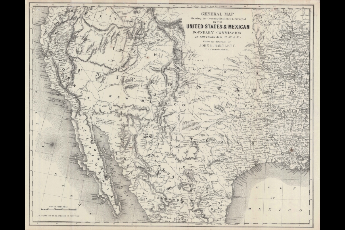
United States and Mexico Boundary Commission by John R. Bartlett, 1853.
style="max-width:1168px;width:1168px;">
class="uds-img figure-img img-fluid"
alt="Granata Nova et California by Cornelius van Wytfliet, 1528"
title="Granata Nova et California by Cornelius van Wytfliet, 1528">
data-testid="image-content-container">
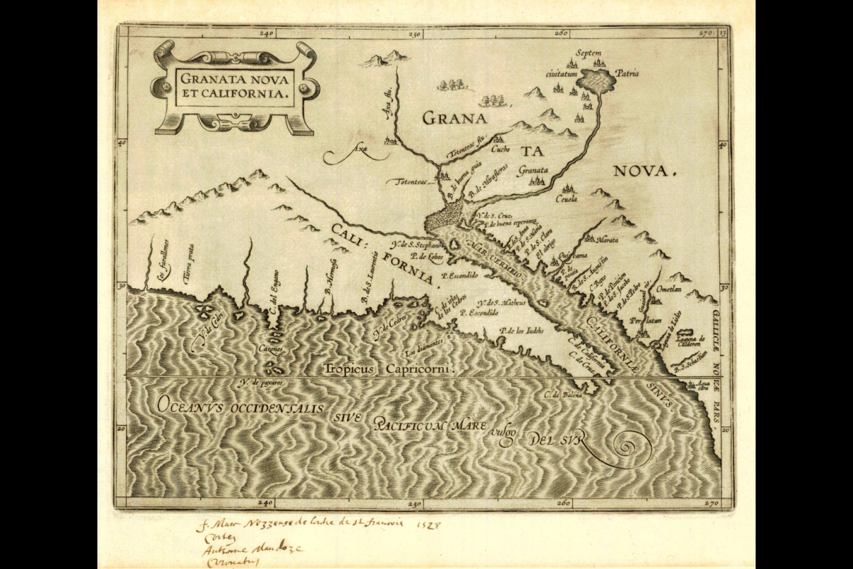
Granata Nova et California by Cornelius van Wytfliet, 1528.
style="max-width:1168px;width:1168px;">
class="uds-img figure-img img-fluid"
alt="Americae Sive Indiae Occidentalis Tabula Generalis by Philipp Clüver, 1672"
title="Americae Sive Indiae Occidentalis Tabula Generalis by Philipp Clüver, 1672">
data-testid="image-content-container">
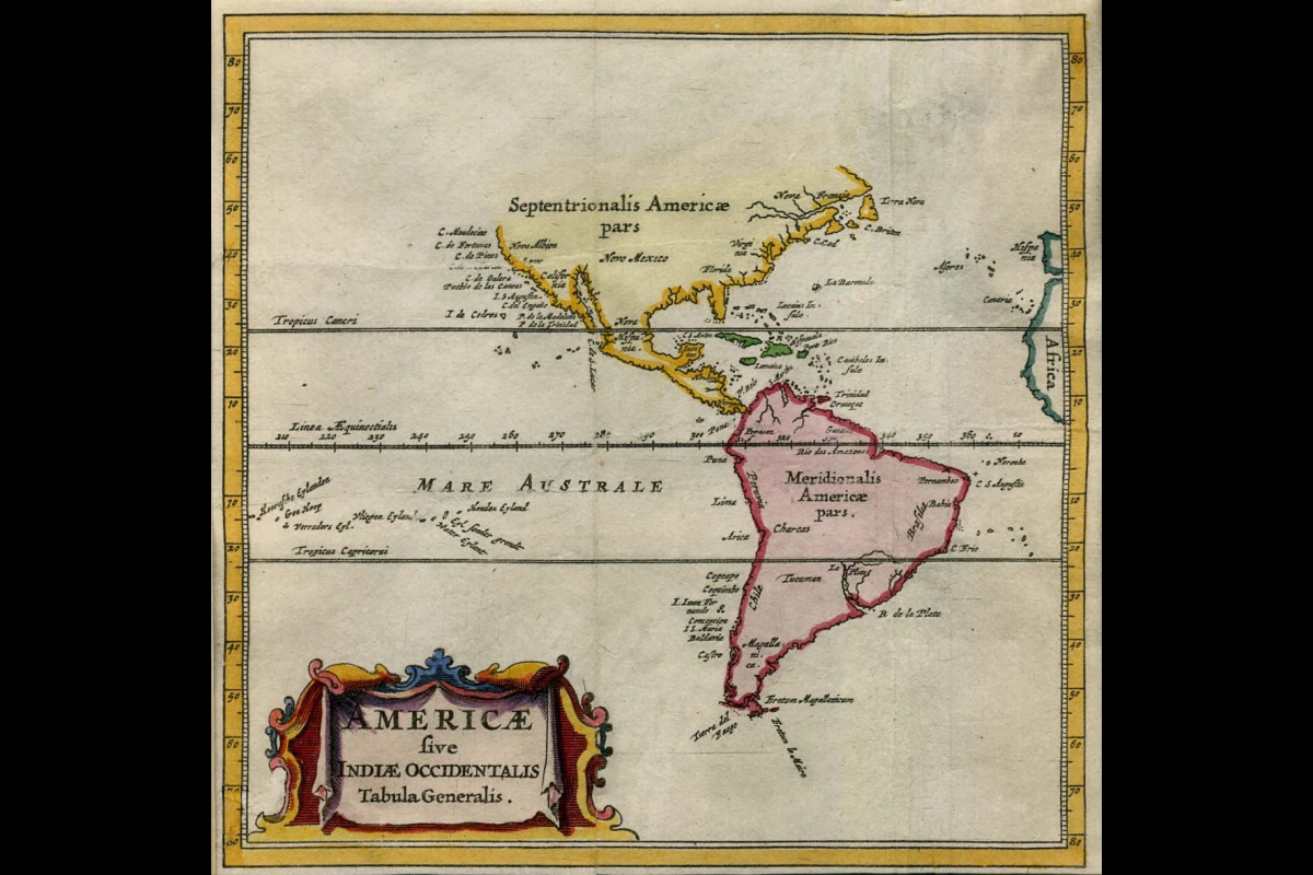
Americae Sive Indiae Occidentalis Tabula Generalis by Philipp Clüver, 1672.
style="max-width:1168px;width:1168px;">
class="uds-img figure-img img-fluid"
alt="L'Amerique Septentrionale que fait partie des Indes Occidentales by Jacque Chiquet, 1719"
title="L'Amerique Septentrionale que fait partie des Indes Occidentales by Jacque Chiquet, 1719">
data-testid="image-content-container">
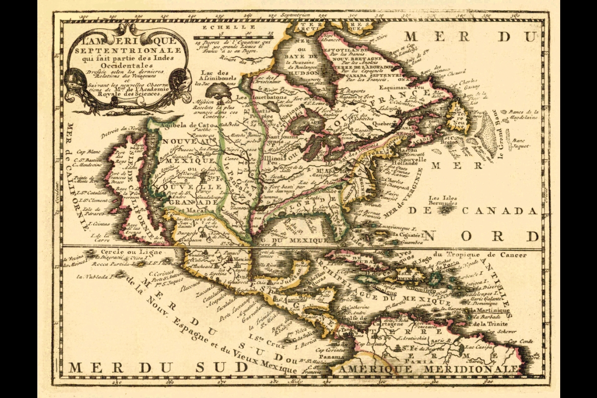
L'Amerique Septentrionale que fait partie des Indes Occidentales by Jacque Chiquet, 1719.
style="max-width:1168px;width:1168px;">
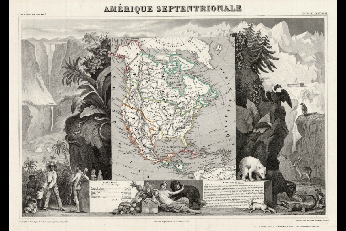
class="uds-img figure-img img-fluid"
alt="Amerique Septentrionale by Victor Levasseur & Raimond Bonheur, 1845-57"
title="Amerique Septentrionale by Victor Levasseur & Raimond Bonheur, 1845-57">
data-testid="image-content-container">
Amerique Septentrionale by Victor Levasseur & Raimond Bonheur, 1845-57.
style="transition: transform 400ms cubic-bezier(0.165, 0.84, 0.44, 1) 0s; transform: translate3d(48px, 0px, 0px);">
data-testid="arrows-container">
More Arts, humanities and education

Pen Project helps unlock writing talent for incarcerated writers
It’s a typical Monday afternoon and Lance Graham is on his way to the Arizona State Prison in Goodyear.It’s a familiar scene.…

Phoenix civil rights activists highlighted in ASU professor’s latest book
As Phoenix began to grow following WWII, residents from other parts of the country moving to the area often brought with them Jim…

Happy mistake: Computer error brings ASU Online, on-campus students together to break new ground in research
Every Thursday, a large group of students gathers in the Teotihuacan Research Laboratory (TeoLab) in the basement of the…