Student cohort takes on Arizona heat
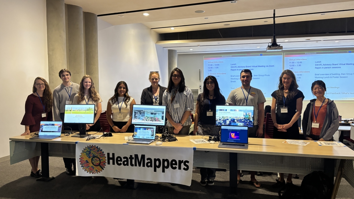
The 2025 participants of the HeatMappers program at the all-hands meeting hosted at University of Arizona. Photo by Sophia Dracopoulos/University of Arizona
In 2022, Arizona State University received $25 million in funding from the U.S. Department of Energy to investigate and gain a better understanding of heat-related stressors across the state of Arizona.
Shortly thereafter, ASU joined forces with Northern Arizona University, University of Arizona, Brookhaven National Laboratory and Oak Ridge National Laboratory to form the Southwest Urban Integrated Field Laboratory (SW-IFL) and investigate the impact of dangerous heat on communities, including the Phoenix metro area.
“Heat and air quality are really the main things that we're looking at. ... This is an integrated field laboratory where we're taking these observations, trying to model them all together and then put solutions in place," said Patricia Solis, research professor in ASU's School of Geographical Sciences and Urban Planning, executive director of ASU's Knowledge Exchange for Resilience and resilient solutions co-lead alongside the University of Arizona’s Ladd Keith for SW-IFL.
This past summer, SW-IFL invited students to work on individual research projects through the six-week initiative HeatMappers. Through the program, students are able to get hands-on experience in laboratory spaces and working on Department of Energy-related projects, where they learn how to use geospatial mapping to study heat. They also learn how to use those maps to communicate the impacts of their research and scientific results to the general public so that scientists and everyday citizens can tackle the negative impacts of extreme heat together.
Solis says the transdisciplinary science communication skills students obtain through the program are helping researchers connect more dots between problems and potential solutions.
“Students are really great at communicating and being a connective tissue between the sciences and the projects they’re working on. That’s why I’m trying to help them learn new tools of geospatial mapping, because maps are good communication and visual tools,” she said.
In their second year of the program, the group experimented with the use of artificial intelligence to communicate, build videos and rapidly map data that was collected.
A hands-on approach to tackle extreme heat
Diane Bañuelos is a junior at ASU studying biological sciences with an emphasis in conservation biology and ecology. She hopes to go into environmental research and water management.
After interviewing for a position in the group, her HeatMappers project took her to the Encanto Golf Course in Phoenix to investigate whether green spaces can cool down surrounding neighborhoods.
“What made me want to contribute was each project's initiative to better understand heat and air quality and its effects on the general public, and how each project is finding ways to communicate their findings with the public," Bañuelos said.
In analyzing collected data, she saw that urban vegetation is in fact playing a large role in cooling down cities, and that golf courses like Encanto are effective at reducing temperatures by providing shade and releasing moisture.
“My biggest takeaway is that through science and research, specifically in HeatMappers, there are three different steps: observations, modeling and solutions. These allowed me to truly understand each step of the research project,” Bañuelos said. “Whether it was driving around collecting air temperature for observations or communicating findings to help local communities and stakeholders grasp the importance of heat resilience for solutions, these were foundational to each project.”

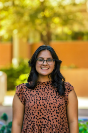
Other projects included ASU earth and space exploration (geological and planetary sciences) major Abby Neumann researching urban flux towers and the quantification of heat exchange, water movement and wind speed and direction, and University of Arizona students Artemis-June Torre and Sophia Dracopoulos mapping the impacts of green infrastructure and trees near bus stops and parking lots.
“My work at HeatMappers had been focused on utilizing the MaRTy cart data collection system, which is a portable cart containing various temperature and solar radiation sensors, among other equipment. This information helps us to gain a more accurate understanding of the temperatures that pedestrians experience in various locations,” Torre wrote in her reflection about her HeatMappers project. “From this, my colleagues and I are working to analyze the impact of things like shade and presence of vegetation on pedestrian comfort, contributing to a broader understanding of how the built environment affects urban heat.”
Dracopoulos added in the project reflection that she hopes this project will show why research matters and how humans — and animals — experience their surrounding environment in intense climatic conditions.
“I hope our story map encourages you to think critically about how people and animals — especially pedestrians who might not own a personal vehicle, people with mobility issues and unhoused people — experience heat and the environment,” she wrote.
Taking steps toward action
The students’ projects concluded at an all-hands meeting at the University of Arizona on Sept. 25, where they presented to SW-IFL’s institutions and stakeholders involved in the initiative.
“During the meeting, the project teams and associated participants shared their results of the last year’s research work and activities,” said Shannon Zweig, a project manager in SW-IFL. “The morning was spent on sharing the project’s collected research, while the second half of the day was focused on how the SW-IFL team can leverage potential opportunities to advance the research that we've started.”
The group hopes that with this student research, the data will ultimately contribute to SW-IFL’s goals of enacting solutions to heat-related issues not only locally, but across the state, nation and globe.
“They added a lot of value with their data collection ... and the deliverables each of them produced in a very short amount of time. Not only were they embedded and dedicated to their science advisor’s work, but also as a cohort, there was great synergy among them,” Solis said. “The collective created some really interesting learning opportunities about the different ways we think about and measure heat, air quality and the systems that are a part of the SW-IFL broader mission.”
More Science and technology

Looking back on 20 years of discovery at ASU’s Center for Bioarchaeological Research
When Christopher Stojanowski works in his lab, he isn’t just handling ancient remains. To him, every tooth or fragment of bone offers a voice from the past and a reminder that scientific data can…

Collaboration is key to the success of ASU’s forensic school, director says
The field of forensic science has expanded rapidly over the past decade, with the U.S. Bureau of Labor Statistics projecting a 14% growth in employment in this area over the next 10 years.Arizona…

Lethal aggression, territorial expansion in wild chimpanzees lead to more births, better infant survival
The Ngogo chimpanzees of Uganda’s Kibale National Park have long been known for violent clashes with neighboring groups, often resulting in deaths — a phenomenon sometimes described as “chimpanzee…