Mapping project helps humanitarian efforts in the wake of the Turkey, Syria earthquake

From a conference room on Arizona State University’s Tempe campus, a group of students have found a way to help survivors of the recent earthquake in Turkey and Syria.
The students are members of YouthMappers ASU, who are part of a rapidly growing global network of 354 university chapters in 72 countries who mapped specific regions in the hardest hit areas of the two countries.
The United Nations estimated that 1.5 million people were left homeless in the wake of the Feb. 6 disaster.
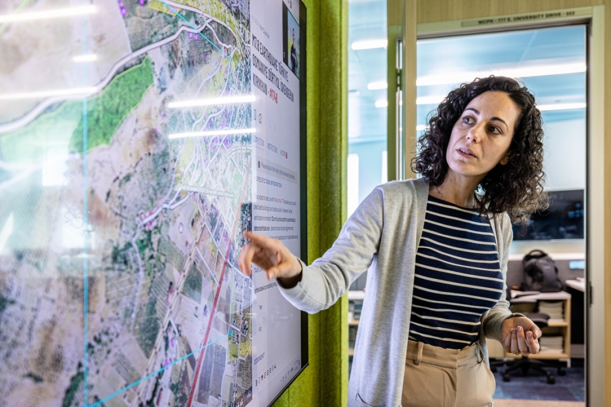
“They (humanitarian groups) need to know what is happening where,” said Patricia Solis, faculty mentor for the group’s ASU’s chapter. Solis is a co-founder and director of YouthMappers.
“By making communities and the built environment visible, then they can respond better,” said Solis, who is also the executive director of ASU's Knowledge Exchange for Resilience.
In the weeks following the quake, buildings were flattened and roads were in ruins. There were massive infrastructure failures throughout both countries. Without maps, it was impossible for charitable groups like Doctors Without Borders and the Red Cross to find people and provide them with food, shelter and medical supplies.
“It was a wonderful opportunity to be able to help those providing humanitarian aid,” said Bryan Leyba, president of YouthMappers ASU. “And to do all of it from afar.”
Mapping meetings
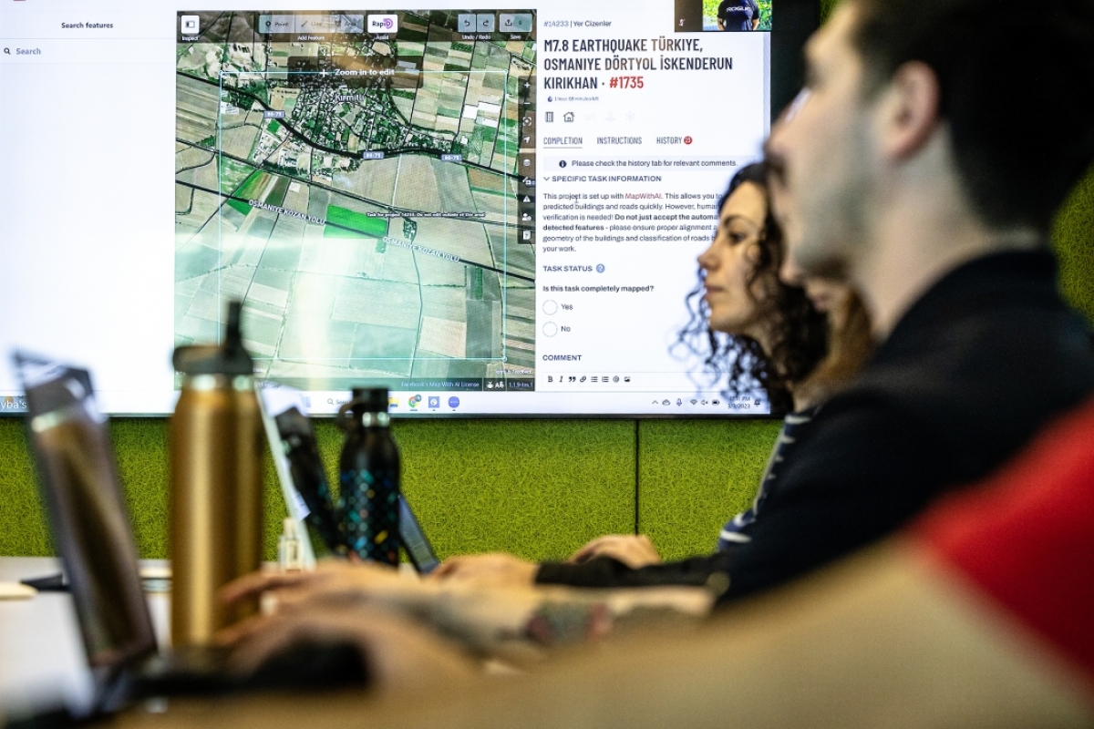
Every Friday at noon for the last few weeks, Leyba — along with about a dozen YouthMappers ASU members — met at the Rob and Melani Walton Center for Planetary Health for some marathon mapping, or, as they like to call it, “mappy hour.”
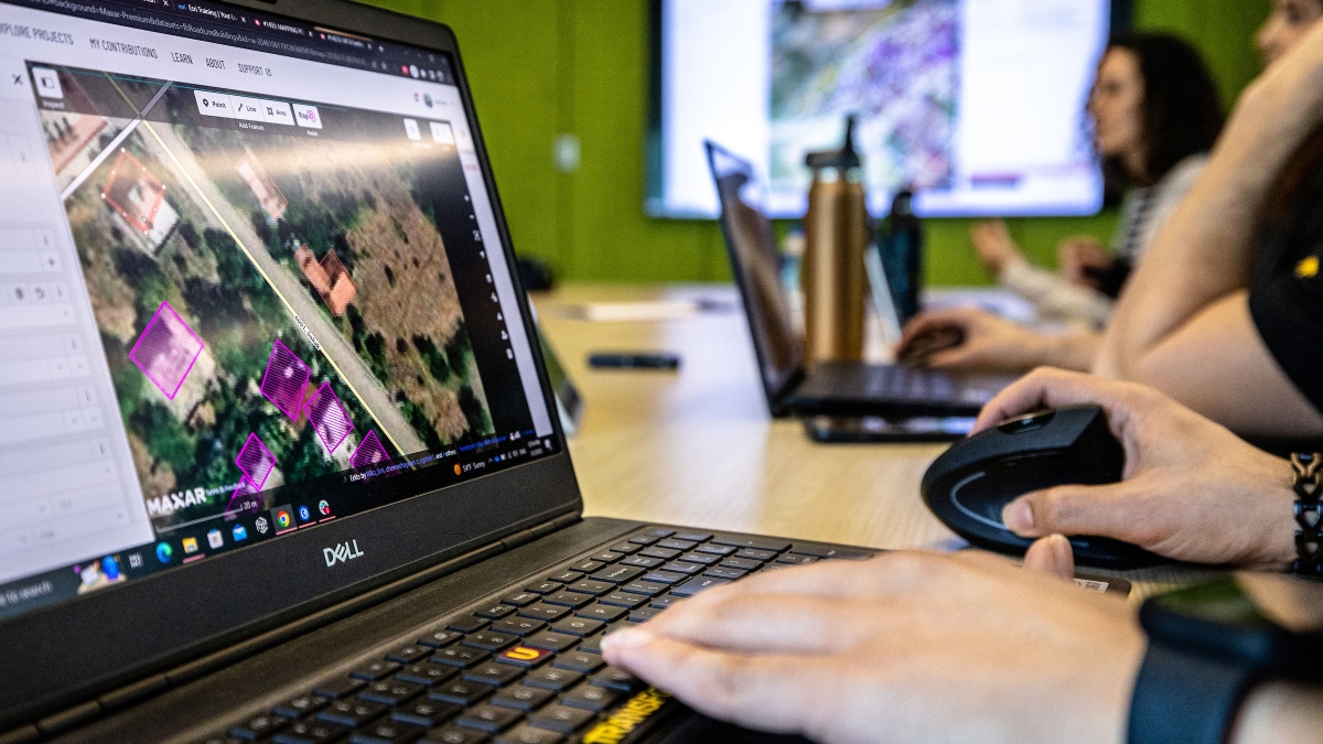
There, the student-led group used geospatial data — time-based information about specific locations in Syria and Turkey — to respond to the natural disaster.
The team used Open Street Map — an open-source platform that combines satellite imagery and computing technologies to provide free, accessible and up-to-date maps of the world.
The platform can be contributed to by anyone and utilized in a myriad of ways. For example, recent imagery can be compared to older imagery to identify changes on the Earth's surface, a capability that is especially useful after a natural disaster like an earthquake.
Non-government and aid organizations can create tasks related to their specific data needs, which are then provided to the Open Street Map community to complete.
Maps are available and accessible to everyone concurrently. ASU students worked alongside students around the world, and contributed, created and added spatial data to the tasks in progress.
Once maps are completed, they are officially verified to ensure accuracy before being released to the charitable organizations.
“We are working with mappers all around the world and updating maps as fast as we can,” said Natalia Arruda, a graduate student in urban planning in ASU’s College of Liberal Arts and Sciences.
Open Street Map can identify buildings that have fallen on the road and provide information about the condition of roads which may not be operable.
“Surprisingly there were places where there were no roads at all,” said Leyba, a graduate student in urban and environmental planning in ASU's School of Sustainability.
Students can locate alternate routes so charitable groups can reach those in need. The technology can also identify the locations of large public spaces such as stadiums, where temporary shelters can be set up.
Diverting future disasters
The earthquake was one of the biggest disasters that the ASU team has worked on, but the YouthMappers have also responded to Hurricane Maria in Puerto Rico and have helped identify areas without electricity in Sierra Leone, West Africa.
The global community of YouthMappers has also helped Arizona with the ongoing issue of heat — particularly as it relates to vulnerable people living in mobile and manufactured homes.
“We work on everything from mobile homes to earthquakes,” said Abdulrahman Alsanad, a recent ASU graduate and geographic information system analyst with Knowledge Exchange for Resilience, who works with the mappers.
“It is our responsibility to help people in need,” said Negar Rahmatollahi, a doctoral student who is studying landscape, architecture and environment.
“Digitizing maps helps us gather important information about how buildings need to be improved,” she said.
She hopes that with better designs and planning, areas can be made more resilient for the future.
“Design policies and guidelines for houses are so important, and solutions need to be available to protect people from future natural disasters.”
Top photo: ASU's Knowledge Exchange for Resilience staffer Abdulrahman Alsanad places colored polygons over existing and destroyed structures in Syria and Turkey at a weekly YouthMappers ASU session on Friday, March 3, at the Walton Center for Planetary Health on the Tempe campus. Photo by Charlie Leight/ASU News
More Environment and sustainability

Driving green desalination
Wilderness survival TV show hosts, pirates and water treatment researchers agree on one thing: Most natural water sources are not safe for drinking. Among the many potential risks is the high salt…

ASU preservation facility serves as test bed for rooftop heat mitigation
A roof coating that uses thermal energy storage materials from Arizona State University spinout EnKoat is halting the heat in several ASU buildings — including a section of the university’s largest…

ASU Carbon Summit displays sustainability leadership, collaboration and ... electric motorcycles
This month, a student-led initiative brought government officials, entrepreneurs and nongovernmental organizations under one roof to discuss sustainable carbon solutions. The annual Carbon…


