ASU to bring Mars to the National Mall

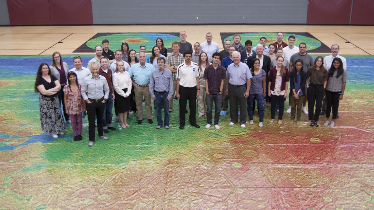
The THEMIS team of scientists stands on the giant map of Mars spread out on a basketball court at Arizona State University. The map for the Mars on the Mall project will be the same size. Photo by Robert Burnham/ASU
A Mars-orbiting camera designed and controlled at Arizona State University is the key ingredient in a project that will place a giant map of Mars on display on the National Mall in Washington, D.C., this spring.
To create the map and bring it to Washington, ASU graduate student Jonathon Hill has received a $10,000 grant from the American Geophysical Union, which is celebrating its 100th anniversary. The award is part of a series of large and small grants to recognize outreach projects that convey "the wonder and excitement of Earth and space sciences" to the public.
Hill is both a PhD student in ASU's School of Earth and Space Exploration and a mission planner for the THEMIS camera on NASA's Mars Odyssey orbiter. THEMIS is short for the Thermal Emission Imaging System, a visible and infrared instrument whose designer and principal investigator is Philip Christensen, Regents' Professor of geological sciences in the School of Earth and Space Exploration.
The map combines 24,000 THEMIS images taken over the mission's entire lifetime, which started Feb. 2, 2001, when the spacecraft began science operations.
"It took THEMIS over 15 years to collect images covering the entire surface of Mars, and then another three years just to stitch them all together," said Hill.
The THEMIS images were taken in Martian daytime at infrared wavelengths. Painstakingly mosaicked and blended, they cover the entire planet pole-to-pole and show every surface feature larger than 100 meters (roughly a football field) in size.
To provide the third dimension, the THEMIS image mosaic is combined with elevation data from another NASA instrument, the Mars Orbiter Laser Altimeter, or MOLA. This instrument's data is colored-coded to show elevation relative to Martian "sea level," which is the planet's average radius. Following terrestrial mapping practices, MOLA elevations below this altitude appear in cool colors, while the higher elevations are in warm tones that turn white at the highest elevations.
The map that will be placed on the mall measures 95 by 48 feet, essentially the same as an NBA basketball court. It is printed on a durable plastic material ordinarily used for billboards and giant advertising that wraps entire buildings. Together with its plastic underpad, the giant map will be tough enough to let visitors walk upon it wearing socks or other soft foot coverings.
Current plans are for Mars on the Mall to be displayed in front of the Smithsonian Institution's National Air and Space Museum for a period of time during the month of May 2019, when Congress is in session. It will also include a weekend so that a large number of visitors to the museum can explore the map.
"From the beginning of Mars Odyssey's mission, the THEMIS team has been keen to convey the excitement of Mars exploration to students and the public," said Christensen. "This is the latest step in that process."
More Science and technology

ASU-led Southwest Advanced Prototyping Hub awarded $21.3M for 2nd year of funding for microelectronics projects
The Southwest Advanced Prototyping (SWAP) Hub, led by Arizona State University, has been awarded $21.3 million in Year 2 funding…

Celebrating '20 Years of Discovery' at the Biodesign Institute
Editor’s note: The Biodesign Institute at Arizona State University wraps up its 20th anniversary with the sixth and final…

Student research supports semiconductor sustainability
As microelectronics have become an increasingly essential part of modern society, greenhouse gas emissions, which are associated…