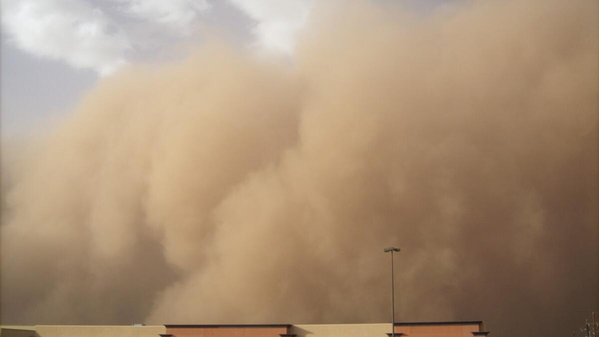
Rainstorms are a welcome visitor in the Phoenix metro area. Not only do they offer a respite from the brutal summer heat, they also help to quell the dust kicked up by another of the Sonoran Desert’s unique charms: the haboobTerm for a type of intense dust storm carried on an atmospheric gravity current, also known as a weather front. Haboobs occur regularly in arid regions throughout the world..
Though the term may elicit giggles, the beast it refers to is no laughing matter. Air pollutants associated with the gargantuan dust storms have been known to exacerbate preexisting respiratory conditions like asthma, cause episodic coughing, intensify cardiovascular ailments and even contribute to the contraction of Valley fever.
And even though Maricopa County has more air-pollutant monitors than are required by the Environmental Protection Agency, there are still vast swaths of land where they are lacking. To get a more comprehensive view of air quality in the Valley of the Sun, a team of Arizona State University students worked with NASA’s DEVELOP program and Maricopa County Department of Public Health over the course of 10 weeks to design a model that can predict air quality in places where there are fewer monitors.
A more comprehensive view means a better idea of which areas need improvement, which could lead to better air quality overall, explained David Hondula, assistant professor of climatology and atmospheric science at ASU. Hondula served as a faculty adviser to the team of three undergraduates.
As one of the country’s most arid regions, Maricopa County is at a specific risk for higher concentrations of particulate matter — that annoying combination of dirt, sand and other nefarious fine particles that sting your eyes on windy days.
Debris from things like wood burning, construction sites, farming and mining all contribute to levels of particulate matter.
“We all know from our experience here that when a dust storm comes in, it’s going to do a lot to elevate particulate matter,” said Lance Watkins, a graduate student at the School of Geographical Sciences and Urban Planning. Watkins, who has participated in past NASA DEVELOP projects, served as a mentor of sorts to the team.
The topography of the area only makes matters worse.
Maricopa County Air Quality Department atmospheric scientist Ronald Pope explains how particulate matter monitors work. The monitor in his hand is part of a PM10 (particulate matter 10 microns or less in size) device. DEVELOP adviser and ASU assistant professor David Hondula and DEVELOP team member Leslie Araujo look on.
Surrounded by mountains, the Phoenix metro area is “like a bowl” in which air pollutants become trapped, explained Ronald Pope, atmospheric scientist for the Maricopa County Air Quality Department who served as an adviser to the DEVELOP team. With nowhere to go, those pollutants end up in the lungs of Valley residents who live and breathe in that “bowl.”
To get a handle on it, the team compared particulate matter measurements from NASA’s MODIS level 2 aerial optical depth satellite to particulate matter measurements from Maricopa County Air Quality Department’s ground-based monitors. Once they were able to discern a relationship between the two, they were able to predict particulate matter measurements for the areas in which they had satellite data but no ground-based monitor data.
“Being able to correlate [satellite data] to data from ground-based monitors is a huge accomplishment,” said team member Tamara Dunbarr, a senior geography major.
It’s a logistical feat that will also allow for more targeted mitigation strategies, such as watering down construction sites and vacant lots, and alerting the public of high-risk areas.
The team performed so well that the project has been approved to continue during the fall semester with a second 10-week term, during which they plan to further refine and enhance their model.
The DEVELOP program does more than just enrich students academically, though. According to Watkins, “The thing that’s most beneficial to student in this program is that they’re getting experience working with a variety of partners and end users on real-world issues.”
This past August, Dunbarr presented the project at NASA’s annual Earth Science Applications Showcase in Washington, D.C.
Hondula says he is grateful to NASA and the Maricopa County departments that contributed to the project, and he looks forward to future collaborations:
“We’re hopeful that NASA DEVELOP is going to be part of the ASU portfolio for the foreseeable future.”
More Health and medicine

New study seeks to combat national kidney shortage, improve availability for organ transplants
Chronic kidney disease affects one in seven adults in the United States. For two in 1,000 Americans, this disease will advance to kidney failure.End-stage renal failure has two primary…

New initiative aims to make nursing degrees more accessible
Isabella Koklys is graduating in December, so she won’t be one of the students using the Edson College of Nursing and Health Innovation's mobile simulation unit that was launched Wednesday at Arizona…

Reducing waste in medical settings
Health care saves lives, but at what cost? Current health care practices might be creating a large carbon footprint, according to ASU Online student Dr. Michele Domico, who says a healthier…


